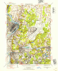
1946 Map of Springfield North
USGS Topo · Published 1954About this map
Industrial expansion and military development define the Pioneer Valley landscape on the eve of the post-war era. The Connecticut River and Chicopee River anchor the region's urban centers, with Holyoke and Chicopee Falls showing the dense street grids and rail sidings of the Boston and Maine RR. A significant portion of the eastern topography is dominated by the sprawling footprint of Westover Field, reflecting the area's strategic importance.
Find a feature on this map
82 named features on this map. Tap any name to fly to it.
Don’t see what you’re looking for? This feature index may not catch every label — zoom into the map to look around manually.
Map Details
Editions of this 1946 Springfield North Map
3 editions found
Other maps of this area

1885 · Northampton
USGS Topo · 1:62,500

1886 · Springfield
USGS Topo · 1:62,500

1886 · Northampton
USGS Topo · 1:62,500

1887 · Palmer
USGS Topo · 1:62,500

1887 · Belchertown
USGS Topo · 1:62,500

1889 · Springfield
USGS Topo · 1:62,500

1889 · Palmer
USGS Topo · 1:62,500

1890 · Belchertown
USGS Topo · 1:62,500

1891 · Northampton
USGS Topo · 1:62,500

1893 · Northampton
USGS Topo · 1:62,500