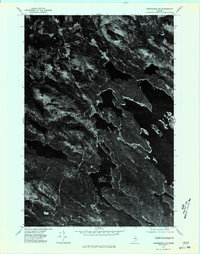
1975 Map of Springfield SE
USGS Topo · Published 1980About this map
Junior Lake dominates this orthophotograph of the Maine woods, showing the complex shoreline and islands of this large water body as they appeared in the mid-1970s. Unlike traditional topographic maps, this orthophotoquad provides a direct visual record of the forest cover and land use patterns surrounding Springfield. The imagery reveals a landscape of dense timberland interrupted by the stark, dark expanse of the lake, offering an unmediated look at the terrain's texture and the few clearings that mark human presence. The photographic detail allows for a clear distinction between various types of vegetation and the natural drainage patterns that flow through the Penobscot County interior.
Find a feature on this map
2 named features on this map. Tap any name to fly to it.
Don’t see what you’re looking for? This feature index may not catch every label — zoom into the map to look around manually.
Map Details
Editions of this 1975 Springfield SE Map
This is the sole edition of this map. No revisions or reprints were ever made.
Other maps of this area

1931 · Springfield
USGS Topo · 1:48,000

1932 · Nicatous Lake
USGS Topo · 1:48,000

1934 · Nicatous Lake
USGS Topo · 1:62,500

1934 · Springfield
USGS Topo · 1:62,500

1941 · Scraggly Lake
USGS Topo · 1:62,500

1941 · Wabassus Lake
USGS Topo · 1:62,500

1943 · Wabassus Lake
USGS Topo · 1:62,500

1944 · Scraggly Lake
USGS Topo · 1:62,500

1953 · Wabassus Lake
USGS Topo · 1:62,500

1954 · Millinocket
USGS Topo · 1:250,000