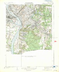
1938 Map of Springfield South
USGS Topo · Published 1938About this map
The Connecticut River serves as the dominant geographic spine of this 1933 survey, separating the urban density of Springfield from West Springfield and Agawam. The industrial and civic development of the era is evident in the concentration of major institutions, including the U S Armory near Winchester Square and the campus of Springfield College situated along the shores of Watershops Pond. The southern reaches of the map transition into the residential and agricultural expanses of Longmeadow and East Longmeadow, where the landscape is dotted with family-named landmarks like McCarthy Hill.
Find a feature on this map
51 named features on this map. Tap any name to fly to it.
Don’t see what you’re looking for? This feature index may not catch every label — zoom into the map to look around manually.
Map Details
Editions of this 1938 Springfield South Map
3 editions found
Other maps of this area

1886 · Springfield
USGS Topo · 1:62,500

1887 · Palmer
USGS Topo · 1:62,500

1889 · Springfield
USGS Topo · 1:62,500

1889 · Palmer
USGS Topo · 1:62,500

1892 · Hartford
USGS Topo · 1:62,500

1892 · Tolland
USGS Topo · 1:62,500

1893 · Springfield
USGS Topo · 1:62,500

1893 · Palmer
USGS Topo · 1:62,500

1895 · Springfield
USGS Topo · 1:62,500

1896 · Holyoke
USGS Topo · 1:125,000