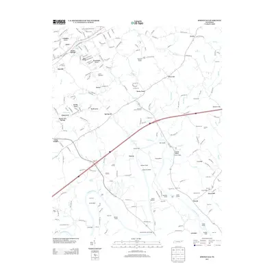
2013 Map of Springvale
USGS Topo · Published 2013About this map
The Nolichucky River flows across this Tennessee landscape, shaping a terrain defined by deep river bends and numerous shoals. Near Inman Bend, the river creates Hurley Island and Steele Island, providing a focal point for the surrounding agriculture and commerce. The distribution of historic family sites and burial grounds, such as Bethesda Cem and Thomas Jarnagin Cem, suggests long-standing community roots. Settlement patterns are dense in areas like Lampkin Acres and Union Heights, while industrial and agricultural infrastructure remains visible through features like the Morristown State Fish Hatchery and Scoot Mill. Waterways such as Turkey Cr and Flat Cr drain into the main river, while transportation is anchored by the David Thomas Jones Bridge and the Susong Bridge. This area reflects a transition between developed residential pockets and the traditional river-valley economy represented by the Creek Store and multiple river crossings like Inman Ford.
Find a feature on this map
95 named features on this map. Tap any name to fly to it.
Don’t see what you’re looking for? This feature index may not catch every label — zoom into the map to look around manually.
Map Details
Editions of this 2013 Springvale Map
This is the sole edition of this map. No revisions or reprints were ever made.
Other maps of this area

1883 · Morristown
USGS Topo · 1:125,000

1893 · Morristown
USGS Topo · 1:125,000

1895 · Morristown
USGS Topo · 1:125,000

1935 · White Pine
USGS Topo · 1:24,000

1935 · Rogersville
USGS Topo · 1:48,000

1935 · Tate Springs
USGS Topo · 1:48,000

1935 · Parrottsville
USGS Topo · 1:24,000

1935 · Springvale
USGS Topo · 1:24,000

1935 · Morristown
USGS Topo · 1:24,000

1935 · Russellville
USGS Topo · 1:24,000