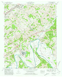
1980 Map of Springvale
USGS Topo · Published 1981About this map
The Nolichucky River winds through the southern half of this landscape, forming the distinctive Inman Bend before widening into the upper reaches of Douglas Lake. This area of Hamblen County reflects a mix of mid-century industrial infrastructure and established rural communities. Near Lowland, a substantial Filtration Plant and Sewage Disposal Plant sit alongside the Southern Railway tracks, highlighting the town's role in supporting regional utility and transit needs.
Find a feature on this map
100 named features on this map. Tap any name to fly to it.
Don’t see what you’re looking for? This feature index may not catch every label — zoom into the map to look around manually.
Map Details
Editions of this 1980 Springvale Map
This is the sole edition of this map. No revisions or reprints were ever made.
Other maps of this area

1883 · Morristown
USGS Topo · 1:125,000

1893 · Morristown
USGS Topo · 1:125,000

1895 · Morristown
USGS Topo · 1:125,000

1935 · White Pine
USGS Topo · 1:24,000

1935 · Rogersville
USGS Topo · 1:48,000

1935 · Tate Springs
USGS Topo · 1:48,000

1935 · Parrottsville
USGS Topo · 1:24,000

1935 · Springvale
USGS Topo · 1:24,000

1935 · Morristown
USGS Topo · 1:24,000

1935 · Russellville
USGS Topo · 1:24,000