
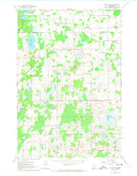
1961 Map of Springvale
USGS Topo · Published 1963About this map
Springvale and the surrounding rural townships of Maple Ridge and Brunswick define this early 1960s landscape along the Kanabec and Isanti County border. The settlement pattern is anchored by a dense network of country institutions, including the Springvale Church and multiple congregations such as North Maple Ridge Ch and South Maple Ridge Ch. Education is locally focused, with scattered schoolhouses like Hiawatha School and Coin School serving the farming community. The terrain is defined by glacial hydrology, featuring Lory Lake, Lewis Lake, and Rice Creek winding through pockets of woodland. Civic life is concentrated at the Townhall and Grange Hall, reflecting a mid-century agricultural economy that remains largely unchanged before later suburban expansion. Small-scale industrial activity is limited to local resource extraction at a Gravel Pit near the northern boundary.
Find a feature on this map
29 named features on this map. Tap any name to fly to it.
Don’t see what you’re looking for? This feature index may not catch every label — zoom into the map to look around manually.
Map Details
Editions of this 1961 Springvale Map
2 editions found
Other maps of this area

1953 · Stillwater
USGS Topo · 1:250,000

1955 · Stillwater
USGS Topo · 1:250,000

1958 · Stillwater
USGS Topo · 1:250,000

1961 · Bradford
USGS Topo · 1:24,000

1961 · Cambridge
USGS Topo · 1:62,500

1961 · Brook Park
USGS Topo · 1:62,500

1961 · Dalbo
USGS Topo · 1:24,000

1961 · Wyanett
USGS Topo · 1:24,000

1961 · Dalbo
USGS Topo · 1:62,500

1965 · Stillwater
USGS Topo · 1:250,000