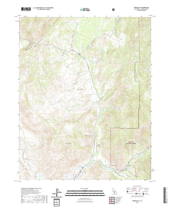
2021 Map of Springville
USGS Topo · Published 2021About this map
The Middle Fork Tule River and N Fork Tule River converge in this high-elevation landscape on the western edge of the Sequoia National Forest. The map shows a transition from the lower elevations near the settlement of Milo to the sharp relief of Blue Ridge and Hatchet Peak. Water management is evident through features like the Mount Whitney Ditch and the natural outflow of Soda Spring, reflecting the historical and ongoing importance of water rights and transport in this part of Tulare County. Access to the high country is provided by winding mountain routes such as Balch Park Rd and Yokohl Dr. Small-scale aviation and localized habitation are represented by the Sequoia Ranch Airport and the community at Sierra Nevada, illustrating how remote outposts utilize the terrain's few flat basins amidst canyons like Siphon Canyon and Ward Canyon.
Find a feature on this map
46 named features on this map. Tap any name to fly to it.
Don’t see what you’re looking for? This feature index may not catch every label — zoom into the map to look around manually.
Map Details
Editions of this 2021 Springville Map
This is the sole edition of this map. No revisions or reprints were ever made.
Other maps of this area

1904 · Kaweah
USGS Topo · 1:125,000

1909 · Kaweah
USGS Topo · 1:125,000

1937 · Kaweah
USGS Topo · 1:125,000

1948 · Fresno
USGS Topo · 1:250,000

1955 · Fresno
USGS Topo · 1:250,000

1956 · Fresno
USGS Topo · 1:250,000
1956 · Globe
USGS Topo · 1:24,000
1956 · Success
USGS Topo · 1:24,000

1956 · Mineral King
USGS Topo · 1:62,500
1956 · Camp Nelson
USGS Topo · 1:62,500