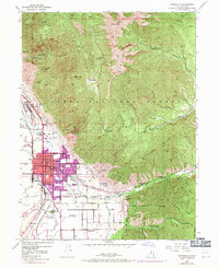
1948 Map of Springville
USGS Topo · Published 1970About this map
Springville serves as the focal point of this survey, illustrating the community's post-war expansion between the base of the Wasatch Mountain range and the industrial activity near Ironton. The map details the town’s civic and educational core, featuring the Lincoln Sch, Grant Sch, High Sch, and Jefferson Sch, along with the City Cem and Evergreen Cem. The western edge of the settlement is defined by the Denver & Rio Grande Western Railroad, while the eastern hills transition into the Uinta National Forest.
Find a feature on this map
76 named features on this map. Tap any name to fly to it.
Don’t see what you’re looking for? This feature index may not catch every label — zoom into the map to look around manually.
Map Details
Editions of this 1948 Springville Map
4 editions found
Other maps of this area

1885 · Salt Lake
USGS Topo · 1:250,000

1907 · Strawberry Valley
USGS Topo · 1:125,000

1909 · Strawberry Valley
USGS Topo · 1:125,000

1948 · Spanish Fork
USGS Topo · 1:24,000

1948 · Orem
USGS Topo · 1:24,000

1948 · Orem
USGS Topo · 1:62,500

1948 · Springville
USGS Topo · 1:24,000

1948 · Provo
USGS Topo · 1:24,000

1948 · Bridal Veil Falls
USGS Topo · 1:24,000

1949 · Provo
USGS Topo · 1:62,500