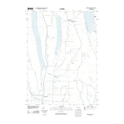
2010 Map of Springwater
USGS Topo · Published 2010About this map
Springwater sits at the base of the Springwater Valley, where Springwater Creek and Limekiln Creek converge. This 2010 survey illustrates a landscape defined by the parallel glaciated basins of Hemlock Lake, Canadice Lake, and Honeoye Lake. The drainage patterns are clearly visible, with the Hemlock Outlet and Canadice Outlet flowing north, while the Cohocton River begins its course in the southeast.
Find a feature on this map
65 named features on this map. Tap any name to fly to it.
Don’t see what you’re looking for? This feature index may not catch every label — zoom into the map to look around manually.
Map Details
Editions of this 2010 Springwater Map
This is the sole edition of this map. No revisions or reprints were ever made.
Other maps of this area

1900 · Naples
USGS Topo · 1:62,500

1900 · Canandaigua
USGS Topo · 1:62,500

1901 · Honeoye
USGS Topo · 1:62,500

1902 · Wayland
USGS Topo · 1:62,500

1903 · Naples
USGS Topo · 1:62,500

1903 · Canandaigua
USGS Topo · 1:62,500

1904 · Wayland
USGS Topo · 1:62,500

1904 · Honeoye
USGS Topo · 1:62,500

1913 · Naples
USGS Topo · 1:62,500

1942 · Springwater
USGS Topo · 1:31,680