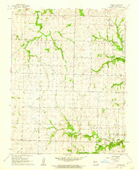
1961 Map of Spruce
USGS Topo · Published 1962About this map
The small community of Ballard serves as a focal point in this 1961 field-checked survey of rural Bates County, Missouri. The landscape is defined by the drainage basins of the Elk Fork and Deepwater Creek, where wooded margins break up the agricultural plateaus of the Shawnee, Spruce, and Summit townships. This map is particularly valuable for genealogical research, documenting a high density of small family or community burial grounds, including Walnut Grove Cem, Antioch Cem, and Radford Cem. The social fabric of the era is evident in the presence of local institutions like Ballard High Sch and Summit Sch, alongside rural congregations at Fairview Ch and Bethel Ch. A singular Quarry indicates localized industrial activity amidst a predominantly agrarian layout, while the network of creeks like Antioch Creek and Fishing Branch reveals the natural hydrology before modern land-use changes.
Find a feature on this map
22 named features on this map. Tap any name to fly to it.
Don’t see what you’re looking for? This feature index may not catch every label — zoom into the map to look around manually.
Map Details
Editions of this 1961 Spruce Map
This is the sole edition of this map. No revisions or reprints were ever made.
Other maps of this area

1887 · Butler
USGS Topo · 1:125,000

1894 · Butler
USGS Topo · 1:125,000

1947 · Lawrence
USGS Topo · 1:250,000

1950 · Lawrence
USGS Topo · 1:250,000

1953 · Johnstown
USGS Topo · 1:24,000
1953 · Creighton
USGS Topo · 1:24,000

1956 · Lawrence
USGS Topo · 1:250,000

1961 · Lawrence
USGS Topo · 1:250,000
1961 · Pleasant Gap
USGS Topo · 1:24,000
1961 · Butler
USGS Topo · 1:24,000