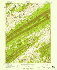
1952 Map of Spruce Hill
USGS Topo · Published 1958About this map
The sharp ridge of Tuscarora Mountain divides this central Pennsylvania landscape, marking the boundary between Juniata and Perry counties in the early 1950s. The northern valley follows the winding course of Tuscarora Creek, where the settlement of Academia and the Lower Tuscarora Church and Cemetery anchor the community's early heritage. Cultural life in these rural townships is documented through numerous small institutions, including the Matamoras School and Church and the Lagrange School.
Find a feature on this map
47 named features on this map. Tap any name to fly to it.
Don’t see what you’re looking for? This feature index may not catch every label — zoom into the map to look around manually.
Map Details
Editions of this 1952 Spruce Hill Map
4 editions found
Other maps of this area

1919 · Mattawana
USGS Topo · 1:62,500

1924 · Lewistown
USGS Topo · 1:62,500

1925 · Mifflintown
USGS Topo · 1:48,000

1927 · Lewisburg
USGS Topo · 1:62,500

1930 · Loysville
USGS Topo · 1:62,500

1933 · Loysville
USGS Topo · 1:62,500

1934 · Mifflintown
USGS Topo · 1:62,500

1936 · East Waterford
USGS Topo · 1:48,000

1937 · Mifflintown
USGS Topo · 1:62,500

1941 · East Waterford
USGS Topo · 1:62,500
Featured Places
- Saville Township, PA
- Spruce Hill Township, PA
- Milford Township, PA
- Pine Grove, Northeast Madison Township
- Beale Township, PA