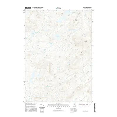
2016 Map of Spruce Lake
USGS Topo · Published 2016About this map
Pillsbury Mtn and the Blue Ridge define this remote section of the Adirondacks, where a dense network of high-elevation waterways feeds into the Jessup River and West Canada Creek. The landscape is dominated by significant bodies of water including Whitney Lake, Sampson Lake, and the namesake Spruce Lake. This 2016 survey illustrates a wilderness largely defined by its natural drainage patterns, from the northern Noisey Inlet down to Fall Stream in the south. Unlike many regions, this area remains remarkably undeveloped, with only primitive routes like Jessup River Rd and the VE Trl providing access through the terrain. For the researcher, the map preserves the exact locations of secluded features like Puddle Hole and Belden Vly, which are often difficult to locate without precise topographic data.
Find a feature on this map
39 named features on this map. Tap any name to fly to it.
Don’t see what you’re looking for? This feature index may not catch every label — zoom into the map to look around manually.
Map Details
Editions of this 2016 Spruce Lake Map
This is the sole edition of this map. No revisions or reprints were ever made.
Other maps of this area

1899 · Indian Lake
USGS Topo · 1:62,500

1900 · Canada Lake
USGS Topo · 1:62,500

1902 · Indian Lake
USGS Topo · 1:62,500

1903 · West Canada Lakes
USGS Topo · 1:62,500

1904 · Piseco Lake
USGS Topo · 1:62,500

1906 · Piseco Lake
USGS Topo · 1:62,500

1907 · Lake Pleasant
USGS Topo · 1:62,500

1908 · Piseco Lake
USGS Topo · 1:62,500

1950 · Utica
USGS Topo · 1:250,000

1954 · Lake Pleasant
USGS Topo · 1:62,500