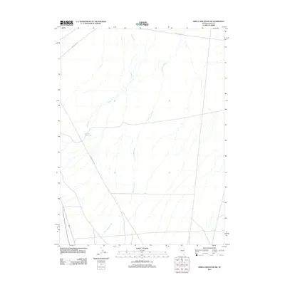
2012 Map of Spruce Mountain NW
USGS Topo · Published 2012About this map
Hastings Cutoff traverses the northern section of this Elko County landscape, marking a significant historical corridor through the high desert of Nevada. This modern survey captures the drainage patterns and historical routes in the vicinity of Spruce Mountain during the early 21st century. The terrain is defined by seasonal waterways, including the winding Three Spring Brook and Spring Cr, which feed into the Ravine Reservoir in the western reaches. The intersection of local transportation history and topography is visible where Old Sprucemont Rd cuts through the sagebrush flats. The map reflects a sparsely populated area where cattle ranching and historical western migration routes like the Hastings Cutoff remain the primary human imprints on the land.
Find a feature on this map
5 named features on this map. Tap any name to fly to it.
Don’t see what you’re looking for? This feature index may not catch every label — zoom into the map to look around manually.
Map Details
Editions of this 2012 Spruce Mountain NW Map
This is the sole edition of this map. No revisions or reprints were ever made.
Other maps of this area
1935 · Halleck
USGS Topo · 1:125,000
1953 · Spruce Mountain
USGS Topo · 1:62,500

1955 · Elko
USGS Topo · 1:250,000

1958 · Elko
USGS Topo · 1:250,000

1962 · Elko
USGS Topo · 1:250,000

1965 · Elko
USGS Topo · 1:250,000
1968 · Snow Water Lake
USGS Topo · 1:24,000
1968 · Ventosa
USGS Topo · 1:24,000
1969 · Gordon Creek
USGS Topo · 1:24,000
1984 · Arizona Spring
USGS Topo · 1:24,000