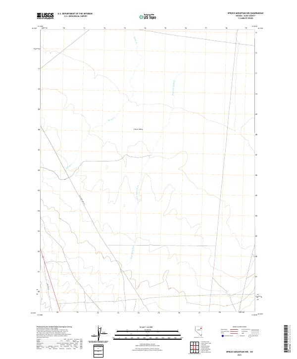
2021 Map of Spruce Mountain NW
USGS Topo · Published 2021About this map
Clover Valley defines the core of this Elko County landscape, where the high desert terrain is shaped by the subtle drainage of Three Spring Brook and Spring Cr. This 2021 survey documents a remote stretch of Nevada where modern passage still follows historical tracks. The presence of Old Hwy 93 and Old Sprucemont Rd indicates how transportation corridors have shifted or been preserved over time, marking the transition from early territorial routes to contemporary infrastructure. These arterial labels are particularly significant for researchers tracing the evolution of regional travel toward the Spruce Mountain mining districts. The map provides a clear look at the Public Land Survey System grid, including townships t33n r62e and t32n r62e, which continue to dictate the organization of this open basin and range country.
Find a feature on this map
9 named features on this map. Tap any name to fly to it.
Don’t see what you’re looking for? This feature index may not catch every label — zoom into the map to look around manually.
Map Details
Editions of this 2021 Spruce Mountain NW Map
This is the sole edition of this map. No revisions or reprints were ever made.
Other maps of this area

1935 · Halleck
USGS Topo · 1:125,000

1953 · Spruce Mountain
USGS Topo · 1:62,500

1955 · Elko
USGS Topo · 1:250,000

1958 · Elko
USGS Topo · 1:250,000

1962 · Elko
USGS Topo · 1:250,000

1965 · Elko
USGS Topo · 1:250,000

1968 · Snow Water Lake
USGS Topo · 1:24,000

1968 · Ventosa
USGS Topo · 1:24,000
1969 · Gordon Creek
USGS Topo · 1:24,000
1984 · Arizona Spring
USGS Topo · 1:24,000