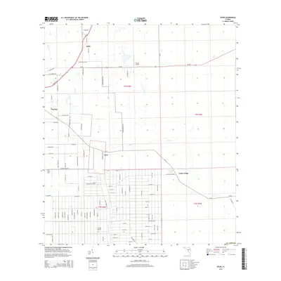
2015 Map of Spuds
USGS Topo · Published 2015About this map
Spuds and Hastings anchor this agricultural region in St. Johns Co, where a complex network of farm-to-market roads reflects the area's deep ties to the potato industry. The landscape is defined by drainage systems like Deep Cr and Sixteenmile Cr, which support the surrounding fields and the small community of Byrd. Transport through the area is facilitated by SR-207 and SR-206, while specialized local routes like Reid Packinghouse Rd and Cracker Swamp Rd point toward the localized rural economy. In addition to the clusters of homes at Gopher Ridge, the presence of Hutson Airfield, Frontier Airport, and the Tater Farms Strip suggests a reliance on small-scale aviation for agricultural or private use. The grid-like survey patterns of t9s r28e and t10s r28e show the systematic division of Florida's coastal interior during this era.
Find a feature on this map
99 named features on this map. Tap any name to fly to it.
Don’t see what you’re looking for? This feature index may not catch every label — zoom into the map to look around manually.
Map Details
Editions of this 2015 Spuds Map
This is the sole edition of this map. No revisions or reprints were ever made.
Other maps of this area

1912 · Palatka
USGS Topo · 1:48,000

1915 · Palatka
USGS Topo · 1:62,500

1937 · Elkton
USGS Topo · 1:24,000

1937 · Crescent Beach
USGS Topo · 1:24,000

1937 · Dinner Island
USGS Topo · 1:48,000

1943 · St. Augustine
USGS Topo · 1:62,500

1943 · Dinner Island
USGS Topo · 1:62,500

1944 · Dinner Island
USGS Topo · 1:62,500

1947 · Bostwick
USGS Topo · 1:50,000
1949 · Riverdale
USGS Topo · 1:24,000