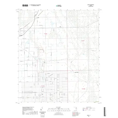
2021 Map of Spuds
USGS Topo · Published 2021About this map
Spuds and Byrd anchor this agricultural and wetland landscape in western Saint Johns County. The area is defined by the transition from the structured grid of farming roads and small settlements to the expansive wetlands of the Big Fish Tail Swamp. Significant transportation history is preserved here along the Palatka To St. Augustine State Trl, which follows a historic rail corridor through the region.
Find a feature on this map
121 named features on this map. Tap any name to fly to it.
Don’t see what you’re looking for? This feature index may not catch every label — zoom into the map to look around manually.
Map Details
Editions of this 2021 Spuds Map
This is the sole edition of this map. No revisions or reprints were ever made.
Other maps of this area

1912 · Palatka
USGS Topo · 1:48,000

1915 · Palatka
USGS Topo · 1:62,500

1937 · Elkton
USGS Topo · 1:24,000

1937 · Crescent Beach
USGS Topo · 1:24,000

1937 · Dinner Island
USGS Topo · 1:48,000

1943 · St. Augustine
USGS Topo · 1:62,500

1943 · Dinner Island
USGS Topo · 1:62,500

1944 · Dinner Island
USGS Topo · 1:62,500

1947 · Bostwick
USGS Topo · 1:50,000
1949 · Riverdale
USGS Topo · 1:24,000