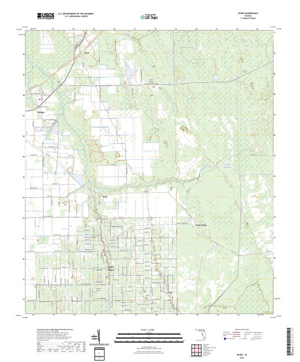
2024 Map of Spuds
USGS Topo · Published 2024About this map
Spuds and the surrounding agricultural lands of St. Johns County are defined by a grid of rural roads and water management systems. The community of Hastings sits near the western edge, connected to the larger region by the Palatka To St Augustine State Trail, which follows the historic route of the Florida East Coast Railroad. This infrastructure reflects the area's long history of moving produce from the fields to coastal markets.
Find a feature on this map
121 named features on this map. Tap any name to fly to it.
Don’t see what you’re looking for? This feature index may not catch every label — zoom into the map to look around manually.
Map Details
Editions of this 2024 Spuds Map
This is the sole edition of this map. No revisions or reprints were ever made.
Other maps of this area

1912 · Palatka
USGS Topo · 1:48,000

1915 · Palatka
USGS Topo · 1:62,500

1937 · Elkton
USGS Topo · 1:24,000

1937 · Crescent Beach
USGS Topo · 1:24,000

1937 · Dinner Island
USGS Topo · 1:48,000

1943 · St. Augustine
USGS Topo · 1:62,500

1943 · Dinner Island
USGS Topo · 1:62,500

1944 · Dinner Island
USGS Topo · 1:62,500

1947 · Bostwick
USGS Topo · 1:50,000
1949 · Riverdale
USGS Topo · 1:24,000