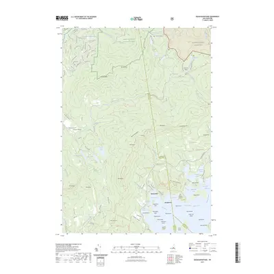
2023 Map of Squam Mountains
USGS Topo · Published 2023About this map
White Mountain National Forest dominates this landscape, where the northern heights of the Sandwich Range descend toward the intricate northern shoreline of Squam Lake. The terrain is defined by prominent peaks including Mt Morgan, Mt Percival, and Mt Weetamoo, which overlook a network of seasonal trails and historic mountain passes. The legendary Sandwich Notch cuts through the mountains, historically serving as a vital corridor between the Pemigewasset and Saco river valleys. Along the lakefront, the settlements of Rockywold and Deephaven sit near the many coves and islands of the northern basin, including Bennett Cove and Five Finger Point. The map also preserves the courses of the Beebe River and Chickenboro Brook, illustrating the drainage patterns that have shaped this area of the Sandwich Range Wilderness for generations.
Find a feature on this map
130 named features on this map. Tap any name to fly to it.
Don’t see what you’re looking for? This feature index may not catch every label — zoom into the map to look around manually.
Map Details
Editions of this 2023 Squam Mountains Map
This is the sole edition of this map. No revisions or reprints were ever made.
Other maps of this area

1909 · Winnepesaukee
USGS Topo · 1:62,500

1925 · Holderness
USGS Topo · 1:62,500

1927 · Holderness
USGS Topo · 1:62,500

1928 · Plymouth
USGS Topo · 1:62,500

1931 · Plymouth
USGS Topo · 1:62,500

1931 · Mt. Chocorua
USGS Topo · 1:62,500

1949 · Portland
USGS Topo · 1:250,000

1956 · Winnipesaukee
USGS Topo · 1:62,500

1956 · Holderness
USGS Topo · 1:62,500

1956 · Portland
USGS Topo · 1:250,000