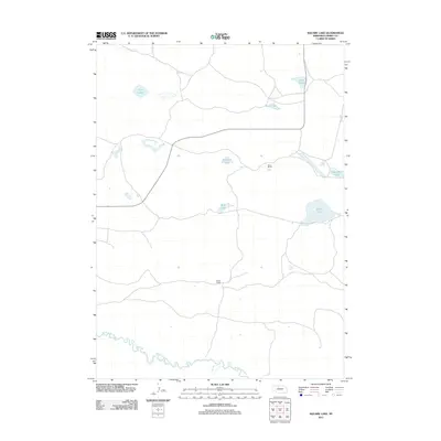
2011 Map of Square Lake
USGS Topo · Published 2011About this map
North Loup River meanders through the southern portion of this high plains landscape, defined by a series of significant lakes and scattered ranching operations in the Nebraska Sandhills. Remote outposts like Sears Ranch and Kidder Ranch mark the human presence in a terrain otherwise dominated by hydrology. The distribution of water bodies such as Square Lake, Robinson Lake, and Mud Lake reveals the characteristic depressions of this region, where shallow groundwater and surface runoff create a mosaic of wetlands. These features, including the isolated Alkali Pond and the connected waters of Packingham Lake, suggest a pastoral economy where water sources dictate the placement of ranch infrastructure and grazing patterns.
Find a feature on this map
10 named features on this map. Tap any name to fly to it.
Don’t see what you’re looking for? This feature index may not catch every label — zoom into the map to look around manually.
Map Details
Editions of this 2011 Square Lake Map
This is the sole edition of this map. No revisions or reprints were ever made.
Other maps of this area

1949 · Big Falls
USGS Topo · 1:62,500

1950 · Powderhorn Valley
USGS Topo · 1:62,500

1950 · Kennedy
USGS Topo · 1:62,500

1951 · Big Falls
USGS Topo · 1:62,500

1951 · Bull Lake
USGS Topo · 1:62,500

1957 · Valentine
USGS Topo · 1:250,000

1959 · Valentine
USGS Topo · 1:250,000

1985 · Mullen
USGS Topo · 1:100,000

1985 · Goose Creek
USGS Topo · 1:100,000

1985 · Cody
USGS Topo · 1:100,000