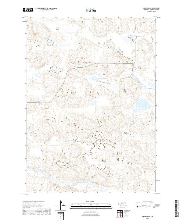
2021 Map of Square Lake
USGS Topo · Published 2021About this map
The North Loup River winds through the southern reaches of this landscape, carving a vital watercourse across the sandhills of Cherry County. This 2021 survey documents a sparsely populated but geographically distinct region characterized by extensive valleys and interior basins. Significant depressions including Big Dry Valley and Wamaduze Valley define the local topography, while a network of isolated water bodies like Square Lake and Robinson Lake dot the terrain. Transportation in the area remains minimalist, centered primarily around Brownlee Rd, which provides north-south access through these quiet rangelands. The map illustrates the fundamental relationship between the river system and the surrounding dry valleys, reflecting the enduring cattle-country character of the Nebraska interior.
Find a feature on this map
14 named features on this map. Tap any name to fly to it.
Don’t see what you’re looking for? This feature index may not catch every label — zoom into the map to look around manually.
Map Details
Editions of this 2021 Square Lake Map
This is the sole edition of this map. No revisions or reprints were ever made.
Other maps of this area

1949 · Big Falls
USGS Topo · 1:62,500

1950 · Powderhorn Valley
USGS Topo · 1:62,500

1950 · Kennedy
USGS Topo · 1:62,500

1951 · Big Falls
USGS Topo · 1:62,500

1951 · Bull Lake
USGS Topo · 1:62,500

1957 · Valentine
USGS Topo · 1:250,000

1959 · Valentine
USGS Topo · 1:250,000

1985 · Mullen
USGS Topo · 1:100,000

1985 · Goose Creek
USGS Topo · 1:100,000

1985 · Cody
USGS Topo · 1:100,000