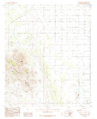
1985 Map of Square Mountain
USGS Topo · Published 1985About this map
Winchester Mountains dominate this high-desert landscape in Cochise County, rising sharply from the eastern plains to the prominence of Square Mountain. The 1985 survey illustrates a rugged terrain carved by seasonal drainages such as Wood Canyon, Bee Canyon, and Long Canyon. Water management is vital in this environment, evidenced by labels for Pine Tank and other stock-watering infrastructure. In the lower elevations to the east, the map reveals a shift toward industrial and transport use, including several Landing Strips and a Gravel Pit. The presence of an Alkali Flat and several transmission towers further characterizes the dry, open character of the basin, while the network of unimproved roads and trails suggests a landscape managed for ranching and utility access rather than dense settlement.
Find a feature on this map
12 named features on this map. Tap any name to fly to it.
Don’t see what you’re looking for? This feature index may not catch every label — zoom into the map to look around manually.
Map Details
Editions of this 1985 Square Mountain Map
This is the sole edition of this map. No revisions or reprints were ever made.
Other maps of this area

1922 · Willcox
USGS Topo · 1:125,000

1943 · Willcox
USGS Topo · 1:62,500

1943 · Cochise
USGS Topo · 1:62,500

1943 · Dragoon
USGS Topo · 1:62,500

1943 · Winchester Mts.
USGS Topo · 1:62,500

1945 · Winchester Mts.
USGS Topo · 1:62,500

1954 · Silver City
USGS Topo · 1:250,000

1956 · Tucson
USGS Topo · 1:250,000

1957 · Winchester Mts.
USGS Topo · 1:62,500

1958 · Silver City
USGS Topo · 1:250,000