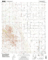
1996 Map of Square Mountain
USGS Topo · Published 2002About this map
Winchester Mountains dominate the western landscape of this Cochise County quadrangle, rising sharply from the desert floor to the summit of Square Mountain. The terrain is defined by complex drainage systems including Wood Canyon Wash and Bee Canyon Wash, which channel seasonal water from the high ridges toward the flatter basins to the east. Evidence of land use and infrastructure is found in the network of numerous Wells and a prominent Pipeline traversing the central territory.
Find a feature on this map
14 named features on this map. Tap any name to fly to it.
Don’t see what you’re looking for? This feature index may not catch every label — zoom into the map to look around manually.
Map Details
Editions of this 1996 Square Mountain Map
This is the sole edition of this map. No revisions or reprints were ever made.
Other maps of this area

1922 · Willcox
USGS Topo · 1:125,000

1943 · Willcox
USGS Topo · 1:62,500

1943 · Cochise
USGS Topo · 1:62,500

1943 · Dragoon
USGS Topo · 1:62,500

1943 · Winchester Mts.
USGS Topo · 1:62,500

1945 · Winchester Mts.
USGS Topo · 1:62,500

1954 · Silver City
USGS Topo · 1:250,000

1956 · Tucson
USGS Topo · 1:250,000

1957 · Winchester Mts.
USGS Topo · 1:62,500

1958 · Silver City
USGS Topo · 1:250,000