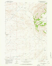
1951 Map of Square Top Butte
USGS Topo · Published 1977About this map
The USAF Bombing Range No 4 (Inactive) occupies a significant portion of this high plains landscape, illustrating the military's use of Wyoming's open spaces during the mid-20th century. Established for the development of the Missouri River Basin, the map details a region where ranching and early energy extraction intersect. The McFarland Ranch sits at the junction of several drainage systems, while signs of petroleum exploration appear in the northeast via an Oil Well and Oil Tanks. The topography is dominated by the prominent Square Top Butte and the wooded slopes of Pine Ridge. The complex hydrology of the area is mapped through various watercourses, including the Powder River and the branching forks of Middle Fork Casper Creek and South Fork Casper Creek. A long Pipe Line cuts across the southern terrain, further reflecting the industrial infrastructure emerging in this part of Natrona County.
Find a feature on this map
13 named features on this map. Tap any name to fly to it.
Don’t see what you’re looking for? This feature index may not catch every label — zoom into the map to look around manually.
Map Details
Editions of this 1951 Square Top Butte Map
2 editions found
Other maps of this area

1951 · Pine Mountain SW
USGS Topo · 1:24,000

1951 · Poison Spider
USGS Topo · 1:24,000

1951 · Square Top Butte
USGS Topo · 1:24,000

1951 · Reid Canyon
USGS Topo · 1:24,000

1955 · Arminto
USGS Topo · 1:250,000

1955 · Casper
USGS Topo · 1:250,000

1958 · Casper
USGS Topo · 1:250,000

1958 · Arminto
USGS Topo · 1:250,000

1959 · Gaylord Reservoir
USGS Topo · 1:24,000

1959 · Eightmile Draw
USGS Topo · 1:24,000