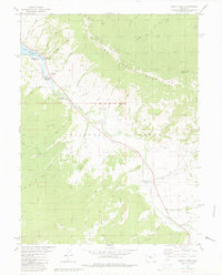
1980 Map of Squaw Creek
USGS Topo · Published 1980About this map
Green Mountain Reservoir dominates the northwest corner of this Colorado landscape, where the Blue River flows through the heart of the Arapaho National Forest. The map documents a recreation-heavy economy along the water, specifically identifying family and group destinations like McDonald Flats Campground, Sucker Junction Campground, and the uniquely named Graveyards Campground Cem. A complex network of drainage gulches, including Lonesome Gulch and Chokecherry Gulch, feeds into the river system from the surrounding peaks.
Find a feature on this map
53 named features on this map. Tap any name to fly to it.
Don’t see what you’re looking for? This feature index may not catch every label — zoom into the map to look around manually.
Map Details
Editions of this 1980 Squaw Creek Map
2 editions found
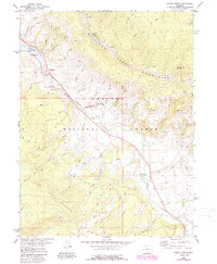
Other maps of this area

1929 · Dillon
USGS Topo · 1:62,500

1933 · Mt. Powell
USGS Topo · 1:48,000

1933 · Ute Peak
USGS Topo · 1:62,500

1934 · Minturn
USGS Topo · 1:62,500

1934 · Dillon
USGS Topo · 1:62,500

1937 · Ute Peak
USGS Topo · 1:62,500

1940 · Mount Powell
USGS Topo · 1:62,500

1950 · Minturn
USGS Topo · 1:62,500

1957 · Leadville
USGS Topo · 1:250,000

1959 · Leadville
USGS Topo · 1:250,000