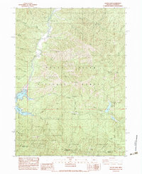
1983 Map of Squaw Lakes
USGS Topo · Published 1983About this map
The Applegate River watershed along the OREGON CALIFORNIA border reveals a landscape of industrial extraction and modern recreation in the early 1980s. The northern portion of the map is defined by the legacy of hydraulic and riverbed mining, clearly indicated by Placer Tailings and a Borrow Pit along the river banks. This transition toward recreational use is anchored by the Applegate Dam and the resulting Applegate Lake, which submerged portions of the canyon formerly occupied by earlier mining and ranching interests.
Find a feature on this map
52 named features on this map. Tap any name to fly to it.
Don’t see what you’re looking for? This feature index may not catch every label — zoom into the map to look around manually.
Map Details
Editions of this 1983 Squaw Lakes Map
This is the sole edition of this map. No revisions or reprints were ever made.
Other maps of this area

1886 · Shasta
USGS Topo · 1:250,000

1891 · Ashland
USGS Topo · 1:250,000

1893 · Ashland
USGS Topo · 1:250,000

1894 · Shasta
USGS Topo · 1:250,000

1897 · Ashland
USGS Topo · 1:250,000

1908 · Grants Pass
USGS Topo · 1:125,000

1914 · Seiad
USGS Topo · 1:125,000

1922 · Seiad
USGS Topo · 1:125,000

1932 · Yreka
USGS Topo · 1:96,000

1938 · Medford
USGS Topo · 1:125,000