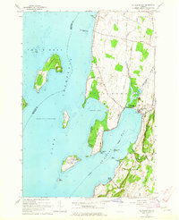
1964 Map of St. Albans Bay
USGS Topo · Published 1965About this map
The eastern shores of Lake Champlain define this mid-1960s landscape, where the waters of St Albans Bay and Lapans Bay cut into the Vermont coastline. The map details a transition from the agricultural interior of Georgia and St Albans townships toward the recreational and maritime focus of the lakefront. Scattered along the peninsula of Hathaway Point and the village of St Albans Bay, the survey records local landmarks such as the State Boat Dock and the St Albans Point Cem.
Find a feature on this map
39 named features on this map. Tap any name to fly to it.
Don’t see what you’re looking for? This feature index may not catch every label — zoom into the map to look around manually.
Map Details
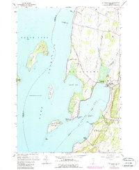
Editions of this 1964 St. Albans Bay Map
2 editions found
Other maps of this area

1894 · Plattsburg
USGS Topo · 1:62,500

1895 · Rouse Point
USGS Topo · 1:62,500

1906 · Plattsburg
USGS Topo · 1:62,500

1907 · Rouse Point
USGS Topo · 1:62,500

1913 · Milton
USGS Topo · 1:48,000

1914 · St. Albans
USGS Topo · 1:48,000

1915 · Milton
USGS Topo · 1:62,500

1916 · St. Albans
USGS Topo · 1:62,500

1939 · Rouses Point
USGS Topo · 1:62,500

1939 · Plattsburg
USGS Topo · 1:62,500