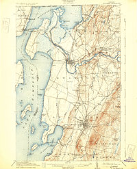
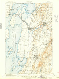
1916 Map of St. Albans
USGS Topo · Published 1931About this map
St Albans serves as the focal point of this Vermont landscape, surveyed just before the First World War. The area is defined by its intricate shoreline along Lake Champlain and Missisquoi Bay, where numerous points and islands like Hog Island and St Albans Point punctuate the water. The regional economy is anchored by the Central Vermont and Grand Trunk railroads, which facilitated transport for local industry, notably at the Fonda Quarry.
Find a feature on this map
109 named features on this map. Tap any name to fly to it.
Don’t see what you’re looking for? This feature index may not catch every label — zoom into the map to look around manually.
Map Details
Editions of this 1916 St. Albans Map
6 editions found
Other maps of this area

1894 · Plattsburg
USGS Topo · 1:62,500

1895 · Rouse Point
USGS Topo · 1:62,500

1906 · Plattsburg
USGS Topo · 1:62,500

1907 · Rouse Point
USGS Topo · 1:62,500

1913 · Milton
USGS Topo · 1:48,000

1914 · St. Albans
USGS Topo · 1:48,000

1915 · Milton
USGS Topo · 1:62,500

1916 · St. Albans
USGS Topo · 1:62,500

1920 · Franklin Pond
USGS Topo · 1:62,500

1922 · Enosburg Falls
USGS Topo · 1:48,000