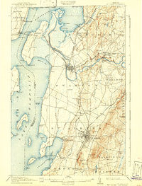
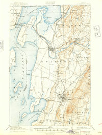
1916 Map of St. Albans
USGS Topo · Published 1942About this map
St Albans serves as the industrial and transit hub of Franklin County in this early 20th-century landscape, where the Central Vermont railroad lines converge. The map documents a complex network of rural education, identifying numerous numbered schoolhouses and named institutions like the French School and Tuller School that once anchored these dairy-farming communities. To the west, Lake Champlain dominates the horizon, featuring a series of large islands including Butler Island and Knight I, while the Missisquoi River winds toward the northern bay, powering local industry at Highgate Falls. The settlement pattern follows both the rail corridors and the shoreline, with seasonal destinations like the Lake View House and Melville Landing catering to early lakeside recreation. Resource extraction is also evident at the Fonda Quarry, situated just south of the rail interchange at Swanton Junction.
Find a feature on this map
107 named features on this map. Tap any name to fly to it.
Don’t see what you’re looking for? This feature index may not catch every label — zoom into the map to look around manually.
Map Details
Editions of this 1916 St. Albans Map
6 editions found
Other maps of this area

1894 · Plattsburg
USGS Topo · 1:62,500

1895 · Rouse Point
USGS Topo · 1:62,500

1906 · Plattsburg
USGS Topo · 1:62,500

1907 · Rouse Point
USGS Topo · 1:62,500

1913 · Milton
USGS Topo · 1:48,000

1914 · St. Albans
USGS Topo · 1:48,000

1915 · Milton
USGS Topo · 1:62,500

1916 · St. Albans
USGS Topo · 1:62,500

1920 · Franklin Pond
USGS Topo · 1:62,500

1922 · Enosburg Falls
USGS Topo · 1:48,000