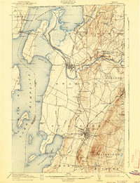
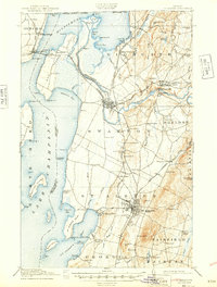
1916 Map of St. Albans
USGS Topo · Published 1940About this map
The eastern shores of Lake Champlain define this landscape, where the Missisquoi River meanders toward the border of the United States Canada boundary line. In the era between the world wars, St Albans stands as a central rail hub, marked by the extensive tracks of the Central Vermont and the Vermont Central railroads. The map reveals an intricate network of rural education with numbered district schools like School No 10 and School No 7 alongside named institutions such as the French School and Webster School. Industrial footprints are visible at the Fonda Quarry and near the falls of the Missisquoi, while the shoreline is dotted with summer destinations like Highgate Springs and the Lake View House. The complex geography of Missisquoi Bay and the islands, including Butler Island and Hog Island, illustrates the maritime character of Franklin County before modern lakeside development.
Find a feature on this map
108 named features on this map. Tap any name to fly to it.
Don’t see what you’re looking for? This feature index may not catch every label — zoom into the map to look around manually.
Map Details
Editions of this 1916 St. Albans Map
6 editions found
Other maps of this area

1894 · Plattsburg
USGS Topo · 1:62,500

1895 · Rouse Point
USGS Topo · 1:62,500

1906 · Plattsburg
USGS Topo · 1:62,500

1907 · Rouse Point
USGS Topo · 1:62,500

1913 · Milton
USGS Topo · 1:48,000

1914 · St. Albans
USGS Topo · 1:48,000

1915 · Milton
USGS Topo · 1:62,500

1916 · St. Albans
USGS Topo · 1:62,500

1920 · Franklin Pond
USGS Topo · 1:62,500

1922 · Enosburg Falls
USGS Topo · 1:48,000