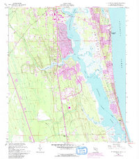
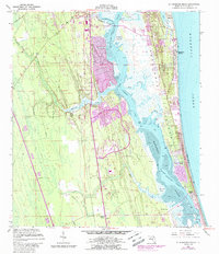
1956 Map of St. Augustine Beach
USGS Topo · Published 1992About this map
Anastasia Island and the coastal barrier system dominate this 1950s era survey, showcasing the geography of St. Johns County before heavy modern development. The Matanzas River and the Intracoastal Waterway separate the mainland from the shore, where St Augustine Beach and Crescent Beach serve as primary seaside settlements. On the mainland, the landscape is defined by tidal estuaries like Moultrie Creek and Moses Creek, with the small community of Dupont Center situated to the south.
Find a feature on this map
28 named features on this map. Tap any name to fly to it.
Don’t see what you’re looking for? This feature index may not catch every label — zoom into the map to look around manually.
Map Details
Editions of this 1956 St. Augustine Beach Map
5 editions found
Other maps of this area

1927 · Matanzas
USGS Topo · 1:48,000

1937 · Bakersville
USGS Topo · 1:24,000

1937 · Elkton
USGS Topo · 1:24,000

1937 · Crescent Beach
USGS Topo · 1:24,000

1937 · Dinner Island
USGS Topo · 1:48,000

1937 · St. Augustine
USGS Topo · 1:24,000

1943 · St. Augustine
USGS Topo · 1:62,500

1943 · Dinner Island
USGS Topo · 1:62,500

1943 · Matanzas
USGS Topo · 1:62,500

1944 · Dinner Island
USGS Topo · 1:62,500
Featured Places
- Saint Augustine, FL
- Saint Augustine Beach, FL
- Saint Augustine South, FL
- Saint Augustine Shores, FL
- Butler Beach, FL