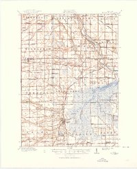
1917 Map of St. Charles
USGS Topo · Published 1950About this map
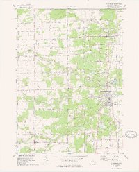
The confluence of the Tittabawassee River, Shiawassee River, and Bad River dominates this Saginaw County landscape, defining the industrial and agricultural patterns of the early twentieth century. St Charles serves as a primary hub, uniquely marked by the presence of coal mining operations such as No 3 Mine. The southern portion of the map showcases the sprawling Prairie Farm and its associated Pumping Station, indicating the sophisticated drainage systems required to manage the wetlands near Alicia. Rail transport is vital to the region's economy, with the Pere Marquette and Michigan Central lines connecting small settlements like Hemlock, Paines, and Fergus. A dense network of rural schools, including the Pakagon School and Geddes School, reflects a well-established community of farmsteads and crossroads such as Shields Corners and Lincoln Corners.
Find a feature on this map
100 named features on this map. Tap any name to fly to it.
Don’t see what you’re looking for? This feature index may not catch every label — zoom into the map to look around manually.
Map Details
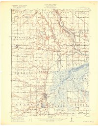
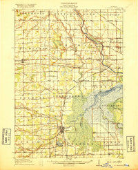
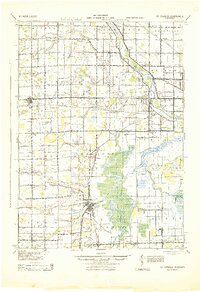
Editions of this 1917 St. Charles Map
4 editions found

Historical Maps of Swan Creek Through Time
3 maps found
Featured Locations
- James Township, MI
- Hemlock, Richland Township
- Swan Creek, James Township
- Saint Charles, Saint Charles Township
- Brant, Brant Township