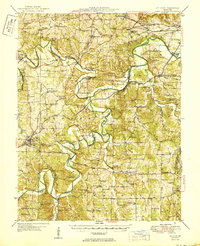
1950 Map of St. Clair
USGS Topo · Published 1950About this map
The Meramec River winds through this mid-century Missouri landscape, creating a complex series of bends and bluffs that define the local geography. Industry and conservation meet along its banks, notably at the Henry Shaw Arboretum and the Virginia Mines (Abandoned) site. The rail networks of the St. Louis - San Francisco and the Chicago Rock Island and Pacific cross the terrain, connecting hubs like St. Clair and Pacific to the broader region.
Find a feature on this map
95 named features on this map. Tap any name to fly to it.
Don’t see what you’re looking for? This feature index may not catch every label — zoom into the map to look around manually.
Map Details
Editions of this 1950 St. Clair Map
This is the sole edition of this map. No revisions or reprints were ever made.
Other maps of this area

1890 · Hermann
USGS Topo · 1:125,000

1901 · De Soto
USGS Topo · 1:125,000

1903 · O'Fallon
USGS Topo · 1:125,000

1903 · Sullivan
USGS Topo · 1:125,000

1934 · Meramec State Park
USGS Topo · 1:24,000

1937 · Pacific
USGS Topo · 1:24,000

1937 · Fletcher
USGS Topo · 1:24,000

1937 · Meramec State Park
USGS Topo · 1:24,000

1938 · Cedar Hill
USGS Topo · 1:24,000

1938 · Fletcher
USGS Topo · 1:24,000