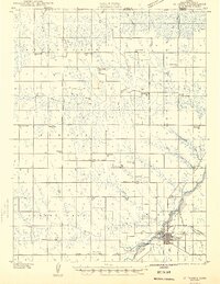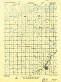
1985 Map of St. Francis
USGS Topo · Published 1988About this map
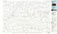
The South Fork Republican River carves a deep valley across the northwest corner of this High Plains landscape, where the town of St Francis serves as a local hub. The map captures the agricultural organization of Cheyenne and Rawlins counties in the mid-1980s, defined by a rigid section grid and a network of small landing strips like the Black Landing Field and Poore Landing Strip that supported the region's aerial needs. The Burlington Northern railroad line runs east-to-west, connecting small settlements such as Wheeler, Bird City, and McDonald. This era shows a landscape managed for both production and conservation, evidenced by the St Francis State Wildlife Management Area and the complex drainage systems of Beaver Creek and Sappa Creek that segment the high plains between scattered grain-handling communities.
Find a feature on this map
56 named features on this map. Tap any name to fly to it.
Don’t see what you’re looking for? This feature index may not catch every label — zoom into the map to look around manually.
Map Details
Editions of this 1985 St. Francis Map
2 editions found
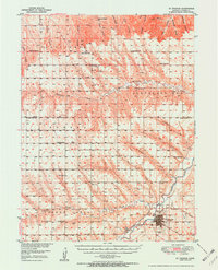
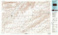
Historical Maps of Saint Francis Through Time
4 maps found