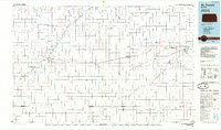
1985 Map of St. Francis
USGS Topo · Published 1985About this map
The High Plains of northwest Kansas are defined here by a network of ephemeral watercourses and canyonlands, most notably the winding course of the Republican River and its many tributaries like Hackberry Creek and Burntwood Creek. The mid-1980s landscape reveals a settlement pattern dictated by the Burlington Northern railroad, which links the towns of St Francis, Bird City, and Atwood. The terrain is deeply incised by named breaks such as Devils Canyon and Dave Hersey Canyon, illustrating the erosional character of the region's drainage towards the northeast. Beyond the established town sites, the map documents a series of private aviation facilities including the Gilliland Landing Strip and Black Landing Field, reflecting the vast distances of the agricultural landscape. Conservation efforts are represented by the St Francis State Wildlife Management Area along the river bottomlands, while local industry is noted through numerous sandpits and quarries scattered across the plains.
Find a feature on this map
63 named features on this map. Tap any name to fly to it.
Don’t see what you’re looking for? This feature index may not catch every label — zoom into the map to look around manually.
Map Details
Editions of this 1985 St. Francis Map
2 editions found
Other maps of this area

1942 · St. Francis
USGS Topo · 1:62,500

1943 · Colby
USGS Topo · 1:62,500

1943 · St. Francis
USGS Topo · 1:62,500

1950 · Bonny Reservoir
USGS Topo · 1:62,500

1950 · Mc Donald
USGS Topo · 1:62,500

1951 · St Francis
USGS Topo · 1:62,500

1951 · Bird City North
USGS Topo · 1:62,500

1951 · Mc Donald
USGS Topo · 1:62,500

1951 · Bird City South
USGS Topo · 1:62,500

1951 · Herndon
USGS Topo · 1:62,500