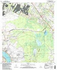
1992 Map of St. Gabriel
USGS Topo · Published 1992About this map
The Mississippi River forms a sharp bend at the southwestern edge of this Louisiana landscape, where the alluvial plain transitions into a complex of wetlands and industrial sites. The settlement of St Gabriel and its associated St Gabriel Mission anchor the riverfront, positioned near massive institutional grounds including the Hunt Correctional Center and the Louisiana Correctional Institute For Women. The region's economy and land use are clearly defined by the extraction industry, with the Burtville Oil Field, Willow Glen Oil Field, and ST Gabriel Gas And Oil Field dotting the lowlands.
Find a feature on this map
61 named features on this map. Tap any name to fly to it.
Don’t see what you’re looking for? This feature index may not catch every label — zoom into the map to look around manually.
Map Details
Editions of this 1992 St. Gabriel Map
This is the sole edition of this map. No revisions or reprints were ever made.
Other maps of this area

1892 · Donaldsonville
USGS Topo · 1:62,500

1908 · Baton Rouge
USGS Topo · 1:62,500

1934 · Denham Springs
USGS Topo · 1:62,500

1935 · Gonzales
USGS Topo · 1:31,680

1936 · White Castle
USGS Topo · 1:62,500

1939 · Denham Springs
USGS Topo · 1:62,500

1939 · Baton Rouge
USGS Topo · 1:62,500

1939 · Donaldsonville
USGS Topo · 1:62,500

1953 · Baton Rouge West
USGS Topo · 1:24,000

1953 · Plaquemine
USGS Topo · 1:24,000