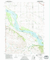
1994 Map of St. Helena
USGS Topo · Published 1995About this map
St Helena and the winding Missouri River define this corner of Cedar County, Nebraska, as it appeared in the early 1990s. The landscape is characterized by the river's dynamic flow, featuring St Helena Island and intricate secondary channels like Sand Chute and The Chute. South of the river, the terrain transitions into a more dissected topography drained by Bow Creek, West Bow Creek, and Second Bow Creek.
Find a feature on this map
20 named features on this map. Tap any name to fly to it.
Don’t see what you’re looking for? This feature index may not catch every label — zoom into the map to look around manually.
Map Details
Editions of this 1994 St. Helena Map
This is the sole edition of this map. No revisions or reprints were ever made.
Other maps of this area

1955 · Sioux City
USGS Topo · 1:250,000

1957 · Gayville
USGS Topo · 1:24,000

1957 · Mission Hill
USGS Topo · 1:24,000

1958 · Sioux City
USGS Topo · 1:250,000

1959 · Sioux City
USGS Topo · 1:250,000

1968 · Obert
USGS Topo · 1:24,000

1968 · St. Helena
USGS Topo · 1:24,000

1968 · Wynot
USGS Topo · 1:24,000
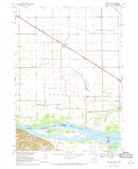
1968 · Meckling
USGS Topo · 1:24,000

1968 · Fordyce
USGS Topo · 1:24,000