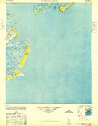
1948 Map of St. Helena Sound
USGS Topo · Published 1948About this map
St Helena Island and the complex salt marsh estuaries of the Lowcountry dominate this mid-century survey, based on aerial photography from the late 1930s. The landscape is a labyrinth of tidal passages including the Morgan River, Harbor River, and Story River, which carve through the dense marshland separating the major sea islands. On Hunting Island, a lone Tower stands near the coast, serving as a significant navigational landmark for the Atlantic Ocean approach.
Find a feature on this map
25 named features on this map. Tap any name to fly to it.
Don’t see what you’re looking for? This feature index may not catch every label — zoom into the map to look around manually.
Map Details
Editions of this 1948 St. Helena Sound Map
2 editions found

Other maps of this area

1918 · Green Pond
USGS Topo · 1:62,500

1919 · Edisto Island
USGS Topo · 1:62,500

1919 · Wadmelaw Island
USGS Topo · 1:62,500

1920 · St. Helena Sound
USGS Topo · 1:62,500

1920 · Hilton Head
USGS Topo · 1:62,500

1943 · Edisto Island
USGS Topo · 1:62,500

1943 · Green Pond
USGS Topo · 1:62,500

1944 · Wadmelaw Island
USGS Topo · 1:62,500

1944 · Fort Fremont
USGS Topo · 1:62,500

1945 · Hilton Head
USGS Topo · 1:62,500
Featured Places
- Edisto Beach, SC
- Cedar Reef Villas, SC
- Oceanmarsh Subdivision, SC
- Nautical Watch Villas, SC
- Charleston County, SC