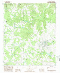
1986 Map of St. Matthews
USGS Topo · Published 1986About this map
St Matthews serves as the focal point of this mid-1980s landscape in Calhoun County, where the transition from agricultural uplands to dense hydrologic networks is clearly defined. The terrain is deeply carved by several significant wetlands and drainages, most notably the wide expanse of Dicks Swamp and Saddler Swamp. These water systems, along with the Halfway Swamp Creek, dictate the placement of local infrastructure and historical settlements. Notable small water bodies like Doodle Hill Pond and Millwood Pond are scattered across the quadrangle, reflecting a landscape shaped by water management and natural catchments.
Find a feature on this map
26 named features on this map. Tap any name to fly to it.
Don’t see what you’re looking for? This feature index may not catch every label — zoom into the map to look around manually.
Map Details
Editions of this 1986 St. Matthews Map
This is the sole edition of this map. No revisions or reprints were ever made.
Other maps of this area

1943 · Eastover
USGS Topo · 1:62,500

1946 · Elloree
USGS Topo · 1:62,500

1946 · St. Matthews
USGS Topo · 1:62,500

1948 · Hopkins
USGS Topo · 1:62,500

1953 · Saylors Lake
USGS Topo · 1:24,000

1953 · Gadsden
USGS Topo · 1:24,000

1953 · Wateree
USGS Topo · 1:24,000

1954 · Augusta
USGS Topo · 1:250,000

1957 · Augusta
USGS Topo · 1:250,000

1958 · Augusta
USGS Topo · 1:250,000