
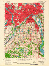
1951 Map of St. Paul
USGS Topo · Published 1959About this map
St Paul and its burgeoning suburbs dominate this mid-century landscape, centered on the strategic confluence of the Mississippi River and the Minnesota River. The historic grounds of the Fort Snelling Military Reservation stand at this junction, adjacent to the early aviation hub of Wold-Chamberlain Airport. The map captures a transitional era of urban expansion, where established educational institutions like Hamline University, St Thomas College, and Macalester College are surrounded by dense residential blocks and industrial facilities such as the Sewage Disposal and Fish Hatchery along the river banks.
Find a feature on this map
127 named features on this map. Tap any name to fly to it.
Don’t see what you’re looking for? This feature index may not catch every label — zoom into the map to look around manually.
Map Details
Editions of this 1951 St. Paul Map
2 editions found
Other maps of this area

1896 · Minneapolis
USGS Topo · 1:62,500

1896 · St. Paul
USGS Topo · 1:62,500

1901 · Minneapolis
USGS Topo · 1:62,500

1902 · White Bear
USGS Topo · 1:62,500

1902 · Anoka
USGS Topo · 1:62,500

1946 · Hudson
USGS Topo · 1:62,500

1948 · Stillwater
USGS Topo · 1:62,500

1949 · Hudson
USGS Topo · 1:62,500

1949 · Stillwater
USGS Topo · 1:62,500

1949 · Lake Elmo
USGS Topo · 1:24,000