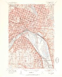
1951 Map of St. Paul East
USGS Topo · Published 1953About this map
The Mississippi River serves as the industrial and geographic anchor of this mid-century survey, dividing the urban heart of St Paul from its southern and western neighbors. To the north, the landscape is defined by the burgeoning neighborhoods of Roseville and a dense network of education and healthcare, including the Gillette State Hospital and Bethesda Hospital. The state’s civic identity is grounded by the State Capitol and the prominent St Paul Cathedral, while the eastern side shows the recreational value of Phalen Park and Beaver Lake.
Find a feature on this map
121 named features on this map. Tap any name to fly to it.
Don’t see what you’re looking for? This feature index may not catch every label — zoom into the map to look around manually.
Map Details
Editions of this 1951 St. Paul East Map
2 editions found

Other maps of this area

1896 · St. Paul
USGS Topo · 1:62,500

1902 · White Bear
USGS Topo · 1:62,500

1946 · Hudson
USGS Topo · 1:62,500

1948 · Stillwater
USGS Topo · 1:62,500

1949 · Hudson
USGS Topo · 1:62,500

1949 · Stillwater
USGS Topo · 1:62,500

1949 · Lake Elmo
USGS Topo · 1:24,000

1950 · Lake Elmo
USGS Topo · 1:24,000

1950 · St Paul Park
USGS Topo · 1:24,000

1951 · St Paul Park
USGS Topo · 1:24,000