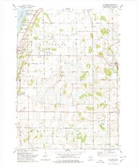
1974 Map of St. Peter
USGS Topo · Published 1978About this map
The eastern shore of Lake Winnebago defines the western edge of this landscape, where recreation spots like Gladstone Beach and Linden Beach meet the limestone rise of the Ledge. This 1974 survey captures a moment in Fond du Lac County's development when agriculture and rural industry coexisted with growing residential pockets near St Peter and Mt Calvary. The terrain transition is marked by numerous Gravel Pits, indicating the geological utility of the glacial drift common to the region.
Find a feature on this map
45 named features on this map. Tap any name to fly to it.
Don’t see what you’re looking for? This feature index may not catch every label — zoom into the map to look around manually.
Map Details
Editions of this 1974 St. Peter Map
This is the sole edition of this map. No revisions or reprints were ever made.
Other maps of this area

1910 · Fond du Lac
USGS Topo · 1:62,500

1954 · Kiel
USGS Topo · 1:62,500

1955 · Campbellsport
USGS Topo · 1:62,500

1955 · Kewaskum
USGS Topo · 1:62,500

1955 · Fond Du Lac
USGS Topo · 1:62,500
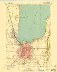
1955 · Fond Du Lac
USGS Topo · 1:24,000

1957 · Madison
USGS Topo · 1:250,000

1960 · Madison
USGS Topo · 1:250,000
1974 · St. Cloud
USGS Topo · 1:24,000
1974 · Dundee
USGS Topo · 1:24,000