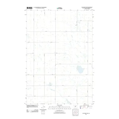
2012 Map of Stafford Dam
USGS Topo · Published 2012About this map
The rolling plains of western Edmunds County are defined by a rhythmic grid of rural section-line roads, such as 350th Ave and 143rd St, which navigate a landscape pockmarked with prairie potholes and small wetlands. In the northeastern portion of the sheet, Saint Johns Cem serves as a quiet landmark for local family histories and early settlement patterns in this agricultural region. Further south, the map features Stafford Dam, a focal point for water management in an area otherwise dominated by seasonal ponds. The network of corridors like Co Rd suggests the enduring importance of transit between isolated farmsteads and the broader county infrastructure during the early 21st century.
Find a feature on this map
16 named features on this map. Tap any name to fly to it.
Don’t see what you’re looking for? This feature index may not catch every label — zoom into the map to look around manually.
Map Details
Editions of this 2012 Stafford Dam Map
This is the sole edition of this map. No revisions or reprints were ever made.
Other maps of this area

1951 · Clark Lake
USGS Topo · 1:24,000

1952 · Norbeck
USGS Topo · 1:24,000

1952 · Wecota
USGS Topo · 1:24,000

1954 · Aberdeen
USGS Topo · 1:250,000

1956 · Aberdeen
USGS Topo · 1:250,000
1974 · Ipswich SE
USGS Topo · 1:24,000

1974 · Roscoe
USGS Topo · 1:24,000

1978 · Loyalton
USGS Topo · 1:24,000
1978 · Stafford Dam
USGS Topo · 1:24,000

1978 · Beebe
USGS Topo · 1:24,000