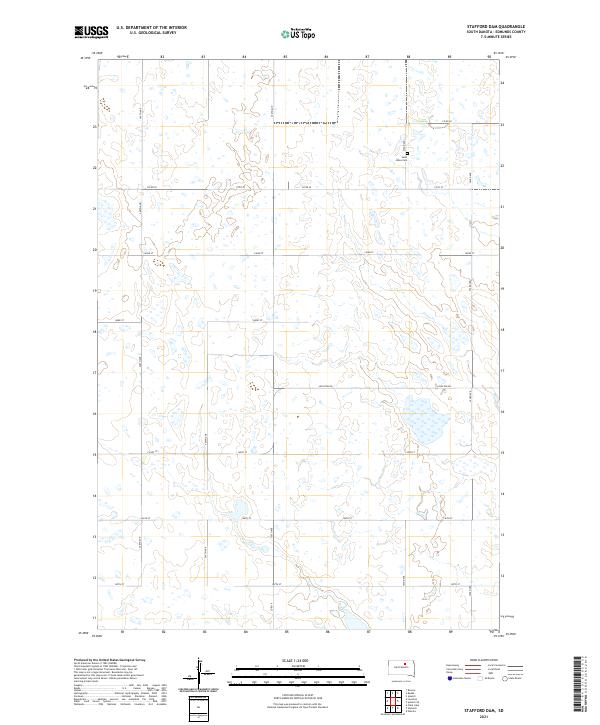
2021 Map of Stafford Dam
USGS Topo · Published 2021About this map
Saint Johns Cem stands as a focal point for family researchers in this rural stretch of Edmunds County. The landscape is defined by the section line grid of the Public Land Survey System, with roads like 349th Ave and 350th Ave marking the boundaries of township and range divisions such as t122n r69w. The terrain is characterized by numerous small prairie potholes and wetlands that interrupt the strictly ordered agricultural blocks. Major local routes including Loyalton Rd and Co Rd 20 provide the primary east-west connectivity through this sparsely populated region. This map illustrates the persistence of the 19th-century township-and-range survey system into the 21st century, where the placement of cemeteries and local corridors remains tied to the original land allotments.
Find a feature on this map
20 named features on this map. Tap any name to fly to it.
Don’t see what you’re looking for? This feature index may not catch every label — zoom into the map to look around manually.
Map Details
Editions of this 2021 Stafford Dam Map
This is the sole edition of this map. No revisions or reprints were ever made.
Other maps of this area

1951 · Clark Lake
USGS Topo · 1:24,000

1952 · Norbeck
USGS Topo · 1:24,000

1952 · Wecota
USGS Topo · 1:24,000

1954 · Aberdeen
USGS Topo · 1:250,000

1956 · Aberdeen
USGS Topo · 1:250,000
1974 · Ipswich SE
USGS Topo · 1:24,000

1974 · Roscoe
USGS Topo · 1:24,000

1978 · Loyalton
USGS Topo · 1:24,000
1978 · Stafford Dam
USGS Topo · 1:24,000

1978 · Beebe
USGS Topo · 1:24,000