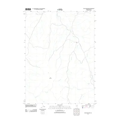
2012 Map of Stag Mountain
USGS Topo · Published 2012About this map
Stag Mountain dominates this portion of Elko County, serving as the topographical center for a network of seasonal drainages and springs. The landscape is characterized by its hydrologic features, with Stag Creek winding through the central valley and Conners Creek and Hanks Creek marking the eastern reaches. Human activity is sparse and concentrated at the Itcaina Ranch, accessed via Co HWY 747. This 2012 survey illustrates the enduring nature of high-desert ranching and water management in Nevada, where vital water sources like Union Spring and Thatcher Spring remain essential landmarks in an otherwise open terrain. The drainage patterns of Summit Creek and Cabin Creek further define the local watershed, illustrating how the geography dictates the placement of travel routes and ranching operations in this isolated corner of the state.
Find a feature on this map
10 named features on this map. Tap any name to fly to it.
Don’t see what you’re looking for? This feature index may not catch every label — zoom into the map to look around manually.
Map Details
Editions of this 2012 Stag Mountain Map
This is the sole edition of this map. No revisions or reprints were ever made.
Other maps of this area

1935 · Charleston
USGS Topo · 1:48,000

1942 · Mt. Velma
USGS Topo · 1:62,500

1955 · Wells
USGS Topo · 1:250,000

1958 · Wells
USGS Topo · 1:250,000

1961 · Wells
USGS Topo · 1:250,000

1967 · Hanks Creek SW
USGS Topo · 1:24,000

1967 · Hot Springs Creek
USGS Topo · 1:24,000

1967 · Stag Mountain
USGS Topo · 1:24,000

1967 · Hanks Creek NE
USGS Topo · 1:24,000

1968 · Charleston Reservoir
USGS Topo · 1:24,000