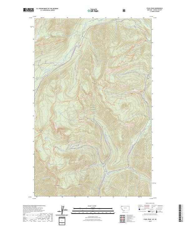
2024 Map of Stahl Peak
USGS Topo · Published 2024About this map
Stahl Peak and the high ridges of the Whitefish Range dominate this northern Montana landscape within the Kootenai National Forest. The 2024 survey details a complex network of forest development roads and recreational trails that define modern access to this backcountry. Central to the map is the headwaters of the Wigwam River and Grave Creek, which carve deep drainages through the Galton Range. The map reveals a land managed for both conservation and recreation, where the Pacific Northwest National Scenic Trail intersects with specialized routes like the Grave Creek Snowmobile Trail. Smaller water bodies like Baboon Lake and numerous named peaks, including Mt Wam and Mt Gibralter, provide essential navigation points for studying the geographical character of the Lincoln County panhandle.
Find a feature on this map
47 named features on this map. Tap any name to fly to it.
Don’t see what you’re looking for? This feature index may not catch every label — zoom into the map to look around manually.
Map Details
Editions of this 2024 Stahl Peak Map
This is the sole edition of this map. No revisions or reprints were ever made.
Other maps of this area

1913 · Stryker
USGS Topo · 1:125,000

1916 · Stryker
USGS Topo · 1:125,000

1957 · Kalispell
USGS Topo · 1:250,000

1960 · Kalispell
USGS Topo · 1:250,000

1961 · Kalispell
USGS Topo · 1:250,000

1963 · Mount Marston
USGS Topo · 1:24,000

1963 · Ksanka Peak
USGS Topo · 1:24,000

1963 · Stahl Peak
USGS Topo · 1:24,000
1963 · Fortine
USGS Topo · 1:24,000
1966 · Mount Thompson-Seton
USGS Topo · 1:24,000