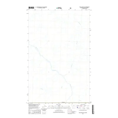
2017 Map of Stahl Peak OE N
USGS Topo · Published 2017About this map
The Wigwam River meanders through this high-altitude landscape just north of the United States border, carving a path through the terrain alongside several key tributaries. This 2017 survey by the U.S. Geological Survey focuses on the drainage patterns of the region, where Desolation Cr feeds into the main river valley from the northeast. The geography is defined by its watercourses, including Rabbit Cr and Weasel Cr, which flow through an area largely untouched by dense settlement or infrastructure. As a borderlands study, the map provides a precise look at the hydrography as it existed in the early 21st century, detailing how these mountain streams converge before crossing the international boundary into Canada.
Find a feature on this map
5 named features on this map. Tap any name to fly to it.
Don’t see what you’re looking for? This feature index may not catch every label — zoom into the map to look around manually.
Map Details
Editions of this 2017 Stahl Peak OE N Map
This is the sole edition of this map. No revisions or reprints were ever made.
Other maps of this area

1913 · Stryker
USGS Topo · 1:125,000

1916 · Stryker
USGS Topo · 1:125,000

1957 · Kalispell
USGS Topo · 1:250,000

1960 · Kalispell
USGS Topo · 1:250,000

1961 · Kalispell
USGS Topo · 1:250,000

1963 · Ksanka Peak
USGS Topo · 1:24,000

1963 · Stahl Peak
USGS Topo · 1:24,000
1966 · Tuchuck Mountain
USGS Topo · 1:24,000
1981 · Whitefish Range
USGS Topo · 1:100,000
1994 · Tuchuck Mountain
USGS Topo · 1:24,000