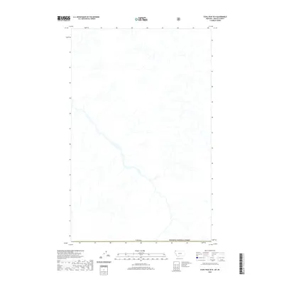
2020 Map of Stahl Peak OE N
USGS Topo · Published 2020About this map
The international border with Canada defines the northern edge of this geographic study, where the wild drainage systems of the northern Rockies flow toward the border. This specific area captures the high-elevation wilderness within the Kootenai National Forest, where steep drainages and mountain streams dominate the landscape. The hydrography of the region is intricate, showing the headwaters and tributaries that eventually feed into the larger river systems of the Pacific Northwest. Because this map represents a cross-border quadrangle, it provides a specialized look at the intersection of American national forest land and the Canadian boundary, focused on the natural watercourses and topography rather than human settlements or road networks, which are entirely absent from this section of the terrain.
Find a feature on this map
2 named features on this map. Tap any name to fly to it.
Don’t see what you’re looking for? This feature index may not catch every label — zoom into the map to look around manually.
Map Details
Editions of this 2020 Stahl Peak OE N Map
This is the sole edition of this map. No revisions or reprints were ever made.
Other maps of this area

1913 · Stryker
USGS Topo · 1:125,000

1916 · Stryker
USGS Topo · 1:125,000

1957 · Kalispell
USGS Topo · 1:250,000

1960 · Kalispell
USGS Topo · 1:250,000

1961 · Kalispell
USGS Topo · 1:250,000

1963 · Ksanka Peak
USGS Topo · 1:24,000

1963 · Stahl Peak
USGS Topo · 1:24,000
1966 · Tuchuck Mountain
USGS Topo · 1:24,000
1981 · Whitefish Range
USGS Topo · 1:100,000
1994 · Tuchuck Mountain
USGS Topo · 1:24,000