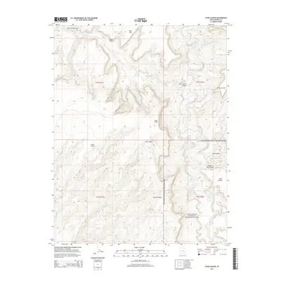
2014 Map of Stair Canyon
USGS Topo · Published 2014About this map
The Dirty Devil River carves a deep path through the eastern portion of this Garfield County landscape, illustrating the intricate drainage patterns of the Colorado Plateau. Much of the southern and eastern territory is preserved within the Glen Canyon National Recreation Area, where a series of dramatic geographic features define the horizon. Significant topographical landmarks like Bert Mesa and Cedar Point overlook a complex system of side-canyons, including Poison Spring Canyon, Stair Canyon, and Hatch Canyon. The layout of the land is further characterized by distinct flatlands and drop-offs such as the Red Benches and Black Jump. This digital-era survey from the U.S. Geological Survey provides a precise look at the township and range divisions, such as t31s r14e, where high points like Buckacre Point stand against the river's winding course.
Find a feature on this map
17 named features on this map. Tap any name to fly to it.
Don’t see what you’re looking for? This feature index may not catch every label — zoom into the map to look around manually.
Map Details
Editions of this 2014 Stair Canyon Map
This is the sole edition of this map. No revisions or reprints were ever made.
Other maps of this area

1885 · San Rafael
USGS Topo · 1:250,000

1886 · Henry Mountains
USGS Topo · 1:250,000

1892 · Henry Mountains
USGS Topo · 1:250,000

1952 · Orange Cliffs 3 SW
USGS Topo · 1:24,000

1952 · Mt Pennell 1 NE
USGS Topo · 1:24,000

1952 · Mt Hillers
USGS Topo · 1:62,500

1952 · Hite
USGS Topo · 1:62,500

1952 · Bull Mountain
USGS Topo · 1:62,500

1953 · Orange Cliffs 3 SE
USGS Topo · 1:24,000

1953 · Orange Cliffs 3 NE
USGS Topo · 1:24,000