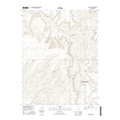
2017 Map of Stair Canyon
USGS Topo · Published 2017About this map
The Dirty Devil River winds through this isolated stretch of Garfield County, marking the transition into the Glen Canyon National Recreation Area. The landscape is defined by its dramatic topographic relief, featuring prominent plateaus and named overlooks such as Bert Mesa, Buckacre Point, and Cedar Point. Access is limited to primitive routes like Poison Springs Wash Rd, which follows the natural drainage of Poison Spring Canyon toward the river.
Find a feature on this map
18 named features on this map. Tap any name to fly to it.
Don’t see what you’re looking for? This feature index may not catch every label — zoom into the map to look around manually.
Map Details
Editions of this 2017 Stair Canyon Map
This is the sole edition of this map. No revisions or reprints were ever made.
Other maps of this area

1885 · San Rafael
USGS Topo · 1:250,000

1886 · Henry Mountains
USGS Topo · 1:250,000

1892 · Henry Mountains
USGS Topo · 1:250,000

1952 · Orange Cliffs 3 SW
USGS Topo · 1:24,000

1952 · Mt Pennell 1 NE
USGS Topo · 1:24,000

1952 · Mt Hillers
USGS Topo · 1:62,500

1952 · Hite
USGS Topo · 1:62,500

1952 · Bull Mountain
USGS Topo · 1:62,500

1953 · Orange Cliffs 3 SE
USGS Topo · 1:24,000

1953 · Orange Cliffs 3 NE
USGS Topo · 1:24,000