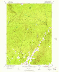
1954 Map of Stamford
USGS Topo · Published 1957About this map
Stamford and the remote settlement of Heartwellville sit at the center of this 1954 topographical study of Bennington County. Much of the landscape is dominated by the Green Mountain National Forest, where the terrain is carved by the North Branch Hoosic River and the West Branch Deerfield River. The map captures the infrastructure of the mid-20th century, from the primary Stage Road to the more isolated Klondike Road leading toward the small enclave of Klondike.
Find a feature on this map
47 named features on this map. Tap any name to fly to it.
Don’t see what you’re looking for? This feature index may not catch every label — zoom into the map to look around manually.
Map Details
Editions of this 1954 Stamford Map
Other maps of this area

1886 · Greylock
USGS Topo · 1:62,500

1886 · Hawley
USGS Topo · 1:62,500

1889 · Wilmington
USGS Topo · 1:62,500

1890 · Hawley
USGS Topo · 1:62,500

1891 · Wilmington
USGS Topo · 1:62,500

1891 · Greylock
USGS Topo · 1:62,500

1893 · Greylock
USGS Topo · 1:62,500

1894 · Hawley
USGS Topo · 1:62,500

1898 · Bennington
USGS Topo · 1:62,500

1898 · Greylock
USGS Topo · 1:62,500